
Discover the Roman Ridge, Rotherham's unique boundary
The mysterious "Roman Ridge" (probably not Roman) ran from Bridgehouses in Sheffield to Swinton and Mexborough. It is thought to be Iron Age, but re-used in Roman and Anglo Saxon Times. It claims to be the longest pre-Roman earthwork in England.
Its purpose (or purposes) is not known but it seems to have been a boundary between The Tribe of the Brigantes and the Romans, and later between the British Kingdom of Elmet and the advancing Anglo Saxon Northumbrians. It is set in an interesting landscape. It is close to Wincobank Fort and Caesar's Camp, in Kimberworth Park, and passes Kimberworth Castle and Mexborough Castle. A Romano- British track running from The Peak district to Pontefract runs behind it on the North West side.
Our walk will take in paths along both Eastern and Western stretches and the enclosure between them in the Greasbrough area, We will then take a short car journey to the best preserved section of the Dyke in Wath Woods. The walk also passes the Mausoleum to the Marquis of Rockingham.
Timings and Tours
Sunday 13 September: 1015-1300 (Approx.)
Tuesday 15 September: 1015-1300 (Approx.)
Directions
Milton Arms, Church St, Greasbrough, Rotherham, S61 4DY
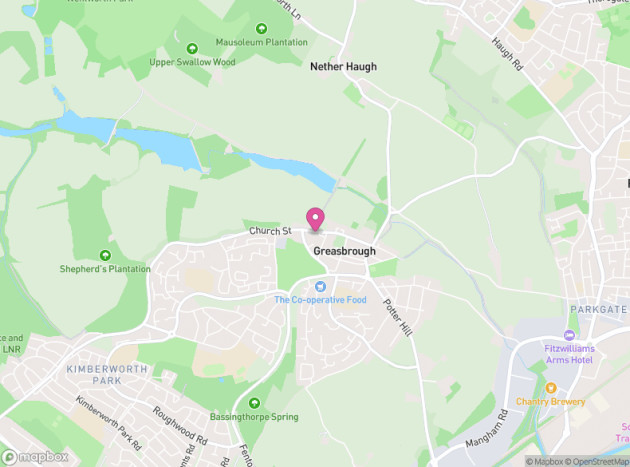
Meet opposite the Milton Arms. There is parking in the area around the war memorial on Church St or on Coach Rd. For the second part of the tour we will drive and park close to Wath wood. Anyone who does not have a car must let the organiser know in advance, though there should not be a problem.
Participants need to be able to walk approx. 5km at a reasonable speed over reasonable footpaths. There is one short steep section (about 200 yards) and a couple of stiles. We cross one quite busy road.
Note dogs on a lead accepted, but there may be grazing animals in fields we have to walk through.
Contact
Jeremy Blundell +447870340856